Cascade Meadow / What We Do
Water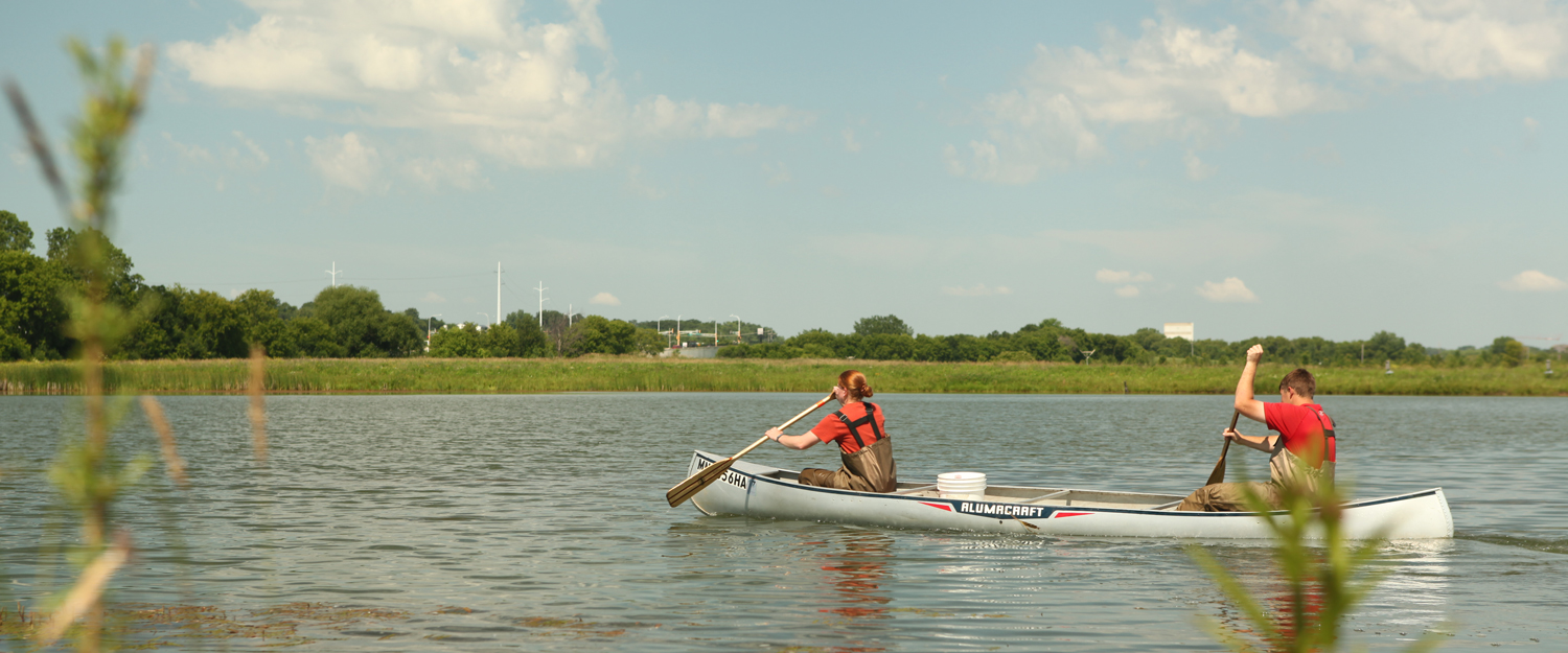
Water
Cascade Meadow has numerous water education initiatives, from indoor exhibits that make plain the functioning and interconnectedness of public water works systems, to the demonstration and interpretation of site-wide storm water best management practices. Navigate through the individual pages listed to the left to learn more.
Water Conservation
Sustainable communities use their resources wisely, and water resources are no exception. Turning on the faucet and instantly receiving a seemingly endless supply of water have led many us into the false assumption that clean water will always be available for our use. In reality, in the face of growing demands on water, conserving this precious resource is a choice we must constantly make.
Cascade Meadow seeks to help citizens in southeast Minnesota identify the places in their homes and work lives where they can use their water more efficiently and eliminate wasting it. Look through the page below to get started. As our resource base grows, we’ll add to this page.
The Quick Word on Water Conservation
Be a Water Detective
Go through your house or business with a pair of water-use “goggles” on! Anyplace where you use water, ask yourself these questions:
- Is there any obvious waste (drips, leaks) here?
- Is there a way I can change how I use water here?
- Is there a technology that I can use to help me use less water here?
Leave no area of the building unexamined. Think through how you use each sink. You might even try keeping a “water log” by your sink to track when, why, and how much water you use there in a day. You might be surprised!
Creative Uses of “Grey” Water Aren’t Black and White
Water that has been used once but is clean enough for another use is sometimes called “greywater.” Greywater could be what’s running down the drain while you wait for the shower or faucet to run hot or water from a fish bowl that you’re cleaning or water that your dehumidifier pulls out of the air in the summer. Whenever and wherever possible, use that water twice! Instead of pouring it down the drain, collect it to water your plants or lawn or to bathe the dog.
Water Conservation Resources
- The Minnesota Pollution Control Agency has some quick tips of their own for water conservation.
- The Environmental Protection Agency has a partnership program called WaterSense that focuses on conservation and efficiency technologies.
*The toilets at Cascade Meadow meet the WaterSense criteria for water efficiency, and the bathroom faucets exceed the efficiency standard set by the WaterSense program by 36%!
Wetlands and Lakes
Wetlands at Cascade Meadow
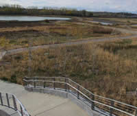 No conversation about water in Minnesota would be complete without talking about wetlands! The natural areas at Cascade Meadow provide us with a unique setting to showcase Minnesota’s diverse wetland types.
7 of 8 distinct MN wetland types
 Did you know that there are eight distinct types of wetlands that occur naturally in Minnesota? Once all of the wetland restoration activities at Cascade Meadow are completed, a total of seven of those wetland types, plus three upland (dry) types, and a ten acre lake will be ready for visitors to experience. Restored with native plants, these wetlands and uplands will be used by diverse wildlife species, will help to regulate water flow through the site, and will help to filter water that eventually enters the Zumbro River. Furthering your knowledge
To learn more about the characteristics of wetlands, the services wetlands provide, and the plants and animals that inhabit them, visit our Wetlands 101 page or come visit us and check out our interactive exhibits. Once the wetland restoration is finished you’ll be able to walk the trails, encounter the wildlife, see the native plants, and stop to rest at the wetland learning way-stations. We hope to see you soon!
Experiencing Wetlands in SE Minnesota and Beyond (coming soon!)
Storm Water Management
One of the areas where Cascade Meadow Wetlands & Environmental Science Center is focusing its water education efforts is in storm water management.
So what is storm water?
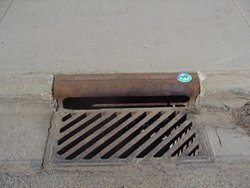 Storm water typically comes from rain or snowmelt that runs off buildings, streets, and other hard surfaces where it does not soak into the ground. These are called impervious surfaces. “Storm” water also includes run-off caused by human water use such as washing cars or over-watering lawns.
In some areas storm water is directed into storm drains, through underground storm sewers, and into storm water treatment devices like ponds or rain gardens. In other areas, however, storm water flows directly into a neighboring waterway. If we don’t intentionally manage storm water in growing urban areas, the amount and flow rate increases and reduces water quality. During large rain events, the volume of storm water running off impervious surfaces can overwhelm storm drains and cause flooding. In addition, because of potential contaminants the U.S. Environmental Protection Agency has identified untreated storm water as the biggest threat to our nation’s water quality. Luckily, effectively managing these storm water issues can have a significant positive impact on water quality, aquatic ecosystems, and our way of life.
Our Best Practices
Cascade Meadow aims to showcase many of the best practices in storm water management. These include:
- Pervious pavements in the areas surrounding the building utilize several pavements that are designed to increase infiltration of storm water and decrease or eliminate storm water run-off. Pervious pavers are installed with gaps between them and pervious layers of gravel and sand beneath them to encourage quick absorption of storm water into the ground. Pervious concrete is mixed with larger-than-usual gravel that makes for gaps throughout the slab through which storm water can flow to the carefully chosen gravels and sands beneath.
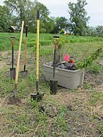
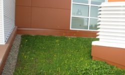
- Landscape shapes called bioswales and biocells are both shaping techniques that are designed with under drain systems. These increase the chance that storm water will be absorbed into the ground before it reaches a storm water pipe system. The biocells and bioswales at Cascade Meadow have been seeded with a special mixture of native plants chosen for their ability to thrive in the unique conditions of a biocell or bioswale.
- Treatment ponds are engineered to manage storm water flows from large drainage areas. The two treatment ponds closest to the Science Center capture and treat water from about 400 acres of land before releasing the water into Cascade Meadow Wetlands and Cascade Creek. The heavy particles and pollutants attached to them settle to the bottom of the pond. Sunlight and aeration stimulate chemical reactions that treat dissolved pollutants, and aquatic plants also absorb some pollutants. Water evaporates from the pond and transpires from the plants to reduce the amount of water discharged into the creek and the wetlands, which are especially sensitive to extreme or frequent water level fluctuations.
- Infiltration terraces are specially-designed run off areas for rainwater that strikes our unique building roof. The water flows into one of two terraces, which are made up of rocks, stone slabs, and layers of rock and sand, where it is quickly absorbed into the ground.
 Green roof is what we call two areas of Cascade Meadows unique roofing. It’s made of a special mix of plants and is designed to absorb the rainwater that strikes these areas. Any water that is not used by them flows off the roof more slowly, cleaner, and cooler than if it had flowed off a roof made of standard material. Excess water then flows from the storm water pipe system into a biocell and is filtered and treated by the special plants and soil organisms there before it is absorbed into the groundwater system.
- Floating Treatment Wetland is a new technology that mimics the natural water treatment functions of wetlands. We installed a one of these – a floating island – in our east pond in 2013 to enhance its water treatment performance, demonstrate innovative solutions, and ultimately protect our wetlands more than a treatment pond could on its own.
When you come to visit, be sure to check out our interactive storm water exhibits inside the building. Take a little time to walk the outdoor “Storm Water Trail,” which highlights all of these storm water best management practices around the building.
Storm Water Resources
The Minnesota Pollution Control Agency (MPCA) advocates for the use of the storm water management technique called “low-impact development” (LID). Read more about LID and access MN resources for LID at the MPCA website.
Check out this “Urban Design Tools” site to learn more about design strategies for storm water management and to see design suggestions and specifications for rain barrels, permeable pavers, and more.
For those of you from the Rochester, MN area, the city storm water management website has information and resources for citizens and businesses including events, permits, and more.
Watersheds
What is a watershed?

Reference provided by: http://www.depweb.state.pa.us/justforkids
A watershed is an area of land that drains to a common body of water. A watershed is defined not by political boundaries but by geographical barriers such as a ridge, hill, or mountain that determine how the water flows over the landscape. When a drop of rain falls on the land, it flows downhill into small creeks and streams, then into larger rivers, and eventually into lakes, wetlands, or the ocean.
Do You Know Your “Watershed Address”?
We all live in a watershed! In fact, we all have what some people call a “watershed address.” Just as your home is located on a street, within a city, within a state, your “watershed address” is the path taken by a water droplet from the moment it falls on or outside your home to when it enters a major waterway. Take a moment to think about where the water that rains on your home goes. After it leaves your lawn, street, or sidewalk, does it flow downhill straight to a nearby stream, to a puddle in your backyard, or to a storm drain that leads to a local creek?
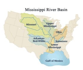 Here in Southeastern Minnesota, we are part of the largest watershed in the United States, the Mississippi River Basin, which drains all or parts of thirty-one states and two Canadian provinces. Large watersheds are composed of smaller, sub-watersheds. In Minnesota there are eighty-one large watersheds. Cascade Meadow is a part of the Zumbro River Watershed, which covers 910,323 acres. This means that any water that falls on or flows through the land surrounding Cascade Meadow will eventually end up in the Zumbro River. From there, it will drain to the Mississippi River and eventually end up all the way down in the Gulf of Mexico.
If you live in the Rochester, MN area, your watershed address is Zumbro River Watershed, Mississippi River Basin!
We All Live Downstream!
The characteristics of a watershed play a large role in how water moves through it. Any changes made to the land will affect the functioning of that watershed. It’s important, therefore, to remember that what we do on the land affects the water quantity and quality for everyone and everything living downstream.
Run-off and Join the Cycle
By the way, not all the water that falls as rain runs off to join a creek or stream. So where does it go? It enters other parts of the water cycle. Some rain evaporates back into the air or filters into the soil where it is either taken up by plants or drains into the subsurface and becomes groundwater.
Watershed Resources
Surf your watershed! Find information about your watershed and groups working on water issues in your watershed by checking out these links:
Environmental Protection Agency
Minnesota Pollution Control Agency
Zumbro Watershed Partnership
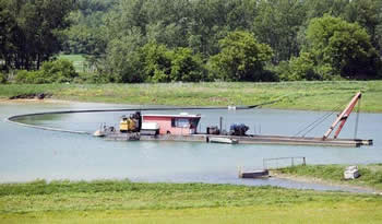
Floating Island
Floating Treatment Wetlands
What’s that island?
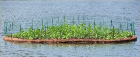 The floating island in our storm water pond is what’s called a Floating Treatment Wetland (FTW). Cascade Meadow installed it in the summer of 2013 to both demonstrate an innovative new technology and to further improve the quality of the water that leaves the pond and enters our wetlands.
How does it work?
Floating Treatment Wetlands mimic some of the water-cleaning (or “treatment”) effects of natural wetlands, namely filtering and nutrient removal. The island is made from a fibrous mat or matrix of recycled plastic which is planted with a variety of appropriate native wetland plants. As the roots of the plants extend through the plastic matrix and into the water, both the roots and matrix become colonized by microorganisms or microbes. These microbes form a green slimy film (referred to as “biofilm” in the graphic below) on the roots and matting. As water flows through the roots and matting, the microbes take up various nutrients, such as phosphorus and nitrates, and filter out suspended solids.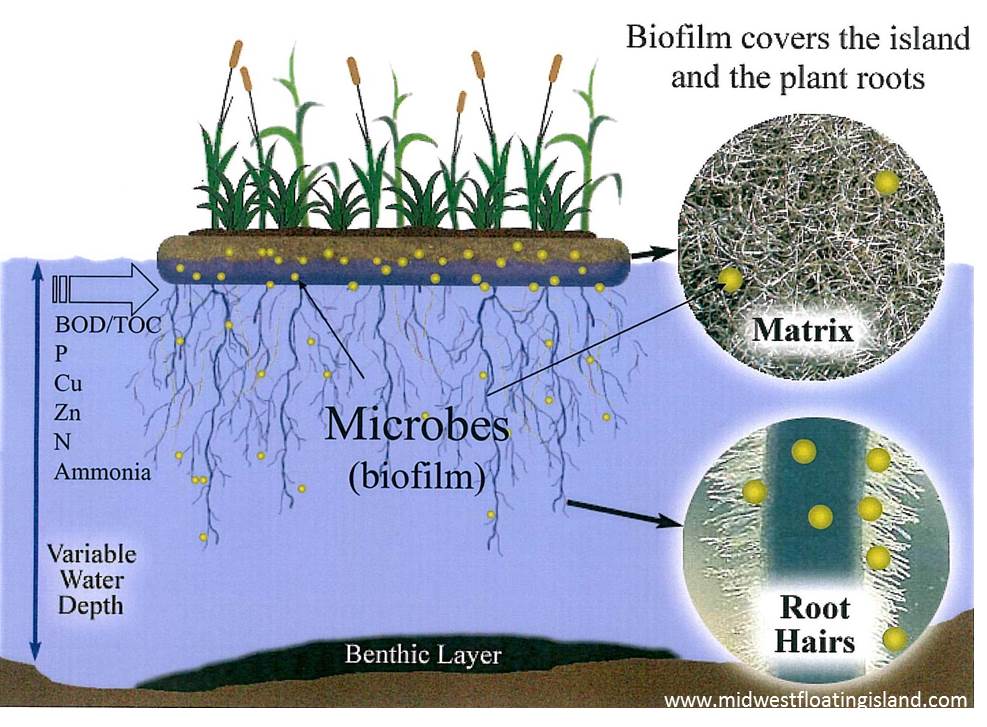
What are the details of this particular project?
 The island is 300 square feet in size and was made in a teardrop shape to echo the logo of Cascade Meadow.
- The island moves up and down easily as water depth changes in the pond, which avoids issues with plants being flooded or drying out.
- It was launched with a mix of over 600 plants including asters and sedges, swamp milkweed, ironweed and other wetland plants to build a filtering root system under the island and an aesthetic mix on top of the island.
- A fence was added to discourage geese from disrupting the new plantings. The fence will be removed once the plants are established.
- It was designed and installed by Midwest Floating Island, Heidi’s Lifestyle Gardens, and Sargent’s Gardens.

 Want to know more?

Here are two detailed descriptions from “Floating Island International,” the holder of the patent on the technology:
“Floating islands have been demonstrated to remove all the typical wastewater parameters of concern – ammonium, nitrate, phosphorus, organic carbon and suspended solids — within a single island body.”
“The microbes and macrophytes uptake nutrients and move them into and through the food chain. Suspended organic particles stick to the biofilm and become periphyton, food for scuds, nymphs and ultimately fish. Suspended inorganic solids, such as heavy metals in particulate form, slough off and settle in the benthic zone beneath the island. The island is a sink for carbon dioxide and it enables nitrates and ammonia to be removed from the water and safely converted back to nitrogen gas.”
Want some really technical data?
Read the technical research paper documenting nutrient removal rates on Midwest Floating Island’s website.
LOCATION
There’s a lot to see in our building, so drop by or contact us by phone or e-mail.
2900 19th Street NW
Rochester, MN 55901
507-457-8699
rochester@smumn.edu
© Copyright 2016. All Rights Reserved. | Privacy | Site Feedback/Changes | Accreditation